The 'crazy, audacious' vision of Jim Desmond
By Laura Oppenheimer Odom, February 4 2015
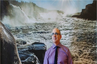 When you walk through Cooper Mountain Nature Park or ride your bike along the Springwater Corridor, you’re following in the footsteps of Jim Desmond.
Desmond arrived at Metro nearly two decades ago to launch the greater Portland region’s first natural areas program. Over the course of two bond measures and a levy, he helped transform voters’ investments into 14,000 acres of protected land, four new nature parks, hundreds of community projects, and 2.5 million new native trees and shrubs.
In January, Desmond left his post as director of Metro’s Sustainability Center to lead the Oregon chapter of The Nature Conservancy. First, he took time to reflect on the region’s movement to protect its iconic landscapes.
Below are highlights of the Q&A, originally published in Metro News. Read the full interview here.
 Q: Before you came to Metro, you worked on the campaign to pass the first successful natural areas bond measure for the region. Tell me a little bit about it.
A: I was working as a project manager for the Trust for Public Land at the time, and they assigned me as their liaison to the campaign. The sense of possibility was great. There was definitely confidence that the measure could pass, but it being so new, no one was quite sure. Looking back on it, interestingly, one of the questions that came up a lot was Metro’s capacity to do this work. Metro had never acquired a single acre of land at that point. So it was really having to instill a sense of confidence in the public that this money would be well spent.
Q: So after the campaign you came to Metro to launch the natural areas program. What was it like that first day? How did you build a team?
A: It really couldn’t have been more “startup.” I tell people that it was like running this new real estate company in the basement of a government building, with the exception that we had $135 million in the bank, and a very clear mandate from the voters of what we were supposed to accomplish.
 Q: When you talk about it “feeling startup,” did you have a sense what it would grow into?
A: To be honest, what’s achieved has been beyond my best-case scenario. When we got here, the 6,000-acre goal seemed really daunting. There was no national precedent for that. I tried to find a program somewhere else in the country that had done something similar, that I could go visit and learn from. What I found out was it just hadn’t been done at this scale in a metropolitan area. There were places that owned 6,000 acres, but they had acquired it all at once. It was daunting.
Q: Now, over the course of two bond measures and two decades, Metro has protected more than 14,000 acres. What comes to mind when you look across that portfolio?
A: To a certain extent, for me, the whole is greater than the sum of its parts. I can look at areas like the Tualatin River, where we’ve bought dozens of properties on the main stem of the river, some headwater sites on various creeks and numerous headwater sites on the 1100-acre Chehalem Ridge. Being the director, I have the privilege of having somewhat of a bird’s-eye view on the whole thing. I can see the huge impact that these two bond measures have had on these resources.
At the same time, when I really sit and think about it, there are individual places and people that I really gravitate to. There are certain places I’m just particularly fond of – Clear Creek, for example. We bought a 500-acre complex that was mostly a former ranch. It’s really a spectacular property; it’s state-park quality, one of the early things we bought. I hold a deep personal affection for that site and a number of others.
 Q: Tell me about one place in the portfolio that seemed impossible when you started.
A: The highest degree of difficulty is a project that’s still in process: the Willamette Falls Legacy Project in Oregon City. The first time I visited the property I was completely overwhelmed by the cement, the 57 buildings there that encompass 900,000 square feet of industrial space, most of which was in an extremely dilapidated condition. It was like an incoherent labyrinth of buildings that were put together over a hundred years. You can’t walk through it with any sense of organization or structure.
Here’s this waterfall that’s by volume the second largest in North America. The first time you stand at the edge of the dam there and look at it, it’s such a staggering natural resource, your jaw drops. The idea that we could turn that into a public asset where people could walk out and have the same experience that I was having there, seemed worth doing. But when I got back to the office and thought about what I’d seen out there, it also seemed like the craziest, most audacious goal we could ever have.
Here we are, three years later. We have a public easement across the riverfront; we have a strong partnership with a private developer; we have partners at the state, county and city level; we’ve secured over $10 million in funds to begin the development of a public walkway. We’ve had thousands of citizens weigh in on their aspirations there and drafted a concept master plan for the future.
 Q: As you know, Metro is developing a plan that will shape our system of regional parks and natural areas for decades to come. If we are bold, what can the region achieve?
A: We have the raw materials now in the way of 14,000 acres. Some of those might not be appropriate for public access – they’re too wet, too sensitive, too steep. But many of them could be spectacular nature parks. They don’t need a lot of bells and whistles. There are plenty of places where a simple, self-guided set of trails and maybe one bathroom and a small parking lot would allow thousands of citizens to experience and explore these places, and really convert what we’ve done from places on a map to real place-making on the ground in ways that will become really special.
There are also terrific opportunities for conservation education, community building, work parties and community-based restoration projects. Just what we’ve seen from our experience with the three parks we opened a few years ago – Cooper Mountain in Beaverton, Graham Oaks in Wilsonville, and Mount Talbert in the Sunnyside area of Clackamas County – imagine if we had seven, eight, 10 more of those. The impact it would have in the community is significant.
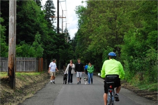
On top of that, we’ve got 900 miles of trail segments that are shown on the regional plan adopted as future trails but haven’t been built yet. When you begin to link these places or link them to some regional centers like downtown Beaverton or downtown Hillsboro, schools or other natural areas, then you build a world-class system.

 Laura Oppenheimer Odom leads Metro’s parks and nature communications team. She worked closely with Jim Desmond, who departed Metro last month to take on a new role as director of The Nature Conservancy’s Oregon chapter.
Add new comment